Bengaluru’s growth as India’s tech capital brought prosperity—but also traffic woes. The city’s scattered IT parks, industrial estates, and residential expansions demanded better connectivity. Enter NICE Road (Nandi Infrastructure Corridor Enterprises Limited), a private-public endeavor launched in the mid-1990s to link southwest Bengaluru, and eventually Bengaluru and Mysuru. Spanning key highways—Tumkur, Mysuru, Kanakapura, Bannerghatta, and Hosur—it was envisioned as a cloverleaf-access toll expressway styled on American parkways
The project began as part of the BMIC masterplan, a visionary blueprint signed in 1995, aiming to integrate ring roads, suburban highways, new townships, and economic corridors via a modern expressway. A public-private partnership (PPP) model saw the acquisition of farmland and forest lands—sparking farmer protests and allegations of excessive procurement . Legally, it’s been contentious from day one.
Today, the 41 km peripheral ring road and 8.5 km link roads are operational, with a 4 km stretch of expressway developed toward Mysuru. But with only partial fulfillment of original plans, NICE Road’s ambition has clashed with commuter expectations
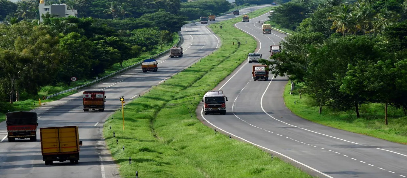
From the outset, the road’s design aimed at fast, uninterrupted travel: access only via toll ramps, grassy medians, emergency shoulders, and high-speed limits. Unlike other Bangalore roads plagued by signals and encroachment, NICE is a controlled-access corridor—but its upkeep hasn’t always matched commuter expectations. Many report potholes and poor lighting at entry/exit ramps, even though toll charges are among the highest in India .
Commuter feedback is polarized: some call it “signal-free bliss” with easy access to Electronics City and Bannerghatta, while others decry the toll at ₹170 per exit and poor road surface on critical stretches .
Proposed Structure
- Why connectivity matters in Bengaluru’s urban sprawl
- Overview of NICE Road’s role in linking IT, industrial, and suburban zones
Origin & Evolution
- History of the Bangalore–Mysore Infrastructure Corridor (BMIC) and NICE consortium inception
- Construction phases: expressway segments, ring road, link roads
Route & Infrastructure
- Alignment: Tumkur to Hosur via Mysuru, Kanakapura, Bannerghatta roads
- Toll ramps, cloverleaf interchanges, median-based metro proposal
- Technical design, quality of roadway vs original expressway vision
Metro & Multi‑Modal Integration
- Proposed 40 km median metro line assessment by BMRCL
- BMTC express bus services, new routes & weekend passes
- Metro interchanges at Kengeri, Mysore Road, and future intermodal nodes
Commuter Experience & Feedback
- Advantages: signal-free commute, access to key corridors
- Complaints: inconsistent road quality, potholes, missing lighting
- Safety issues: speed control, accident zones, VVIP lane controversy
Economic & Real Estate Impact
- How connectivity boosted land values in south and southwest Bengaluru
- Rise of residential layouts (legal & illegal) along NICE corridor
Environmental & Social Factors
- Green initiatives: EV charging, noise barriers, carbon reduction plans
- Conflict: land acquisition, farmers’ protests, abandoned project promises
Governance & Public‑Private Dynamics
- Toll privatization, legal disputes, land acquisition controversies
- Oversight gaps: illegal layouts, vendor regulations, governance bodies
Future Roadmap
- Metro on NICE median, PRR linkups, satellite corridor extension
- Infrastructure upgrades: lighting, interchanges, expressway expansion
Comparative Perspective
- Compare NICE Road with other corridors like Outer Ring Road or Elevated Expressway
- Lessons from international PPP-priority highways
Conclusion
- Balancing infrastructure promise with commuter needs
- Civic engagement, transparent planning, and sustainable urban connectivity